- Water
- River
- Experience
- Confident swimmer
- Access
- Swimming tolerated
- Walk in
- 20 min walk
- Dogs
- Welcome
- Parking
- Free at Kings Tree roadside (weekdays only); Fairholmes is pay and display
About the spot
Slippery Stones is where the young River Derwent runs free above Howden Reservoir, spilling over smooth gritstone slabs into a series of pools before it slows into the reservoir. The main feature is a deep plunge pool about 100 metres upstream of the old stone packhorse bridge, reached by crossing a small footbridge into an open clearing. Around it the river forms shallower runs and mini waterfalls over the slabs, with grassy banks that make good places to sit and sunbathe. The setting is moorland and woodland at the head of the valley, so treat the swim as the reward at the end of a walk or cycle along the reservoirs.
The water is clear but tea-coloured from peat staining, described by one visitor as "crystal clear but tinted brown and strangely fizzy." The main pool is commonly reported at around 3–4 metres deep; depth varies with rainfall and season and is shallower by the bridge where rock platforms make entry easy. The upstream pool is quieter. The water is cold year-round, even in summer.
- What it is: a deep river plunge pool plus shallower rocky runs on the free-flowing upper Derwent, about 100 metres upstream of the packhorse bridge.
- Depth: commonly reported at 3–4 metres; pools can reach about 4 metres in places. Depth varies with rainfall and season; shallower by the bridge.
- Entry: rock slabs and natural platforms at the water's edge near the bridge; gentle gravelly shallows on one side; deeper pool upstream.
- Clarity/character: clear but peat-stained brown, with mini waterfalls over gritstone and large boulders for lounging or jumping.
Who'll love it here
Best suited to confident swimmers comfortable with cold, deep, open water and being self-reliant in a remote place with no lifeguard, no signal and a slow rescue. Casual summer swimmers and families can enjoy the shallows and a careful dip on a warm, settled day, but must respect the deep pool, the current and the cold.
- Experience level: confident; beginners should go with experienced companions and stay in the shallows.
- Distance/training swims: the pool is short and deep, suited to a plunge and a few strokes rather than laps.
- Tow float: advisable given depth, cold and current; it also helps visibility.
- Non-swimmers/paddling: yes, in the shallow rocky runs near the bridge, taking care on slippery rock.
Nearby swimming spots
Fair Brook
Waterfall pool
5 miles southwest
A chain of clear, peat-stained pools beneath small gritstone waterfalls, tucked into a quiet clough on the wild northern side of Kinder Scout. It is a walk-in reward: shallow dips and cool-off plunges among the heather, far from the crowds.
30 min walk
Mermaid's Pool
Lake
7 miles southwest
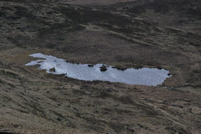
A small, dark, peat-stained moorland tarn high on the western shoulder of Kinder Scout just below Kinder Downfall, with wide views over Kinder Reservoir and the plateau. A legend-soaked novelty dip reached after a long moorland walk rather than a proper swim: shallow, boggy, tea-coloured water and a wild, exposed setting.
90 min walk
Three Shires Head
Waterfall pool
19 miles southwest
A chain of clear, peat-stained pools and small gritstone waterfalls on the young River Dane, right where three counties meet under an old packhorse bridge on open moorland. The water stays cold all year and the setting is wild and remote, reached only on foot.
35 min walk
River Bradford at Youlgreave (Bradford Dale)
River
20 miles south
A stone-walled pool carved into the bed of the crystal-clear River Bradford sits in a quiet limestone valley below the village of Youlgreave, offering a cold, shallow dip among grassy meadows and little weirs. It is one of the Peak District's few river swimming spots and one of its gentlest, calm enough for families on a warm summer day.
15 min walk