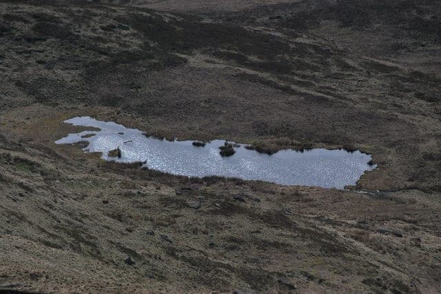
Kinder Scout, near Snake Pass, Peak District
A chain of clear, peat-stained pools beneath small gritstone waterfalls, tucked into a quiet clough on the wild northern side of Kinder Scout. It is a walk-in reward: shallow dips and cool-off plunges among the heather, far from the crowds.
Fair Brook is a string of small waterfalls and plunge pools as the moorland stream drops off the northern edge of Kinder Scout. The pools are peat-stained brown but clear, framed by gritstone and heather; none are large, and the place feels intimate and quiet rather than grand.
What to expect on the water: a series of shallow moorland stream pools below little falls, with a range of depths and sizes. Most pools are paddling depth, knee to waist typical, and a few are described as "deep enough for a few strokes," but exact maximum depth is unknown, so verify locally. You enter over rock and boulders, often slippery. The brook runs straight off open moorland, so the water is peat-stained and cold.
Why people come: the combination of tumbling falls, small natural pools and a wild moorland setting with broad valley views. It is a dip rather than a swim, and a mile or so of rough walking will leave you with very little company on most days.
Fair Brook suits casual to confident wild swimmers and paddlers who are comfortable on rough terrain and want a wild, quiet cool-down rather than a proper swim. It rewards walkers and scramblers who enjoy dipping along a route.
Most people park at the Birchin Clough car park on the A57 Snake Road, nearest postcode S33 0AB, a free roadside/gravel car park. From there the path drops into Snake Woodlands, you cross the Ashop footbridge and then turn up Fair Brook.
There are also a few small laybys on the A57 just below the former Snake Pass Inn, which hold only about eight cars in total and fill early on fine weekends. The Snake Pass Inn closed as a pub on 18 October 2019 and is now private and has holiday accommodation, so do not rely on it for parking or facilities.

3 miles west
A small, dark, peat-stained moorland tarn high on the western shoulder of Kinder Scout just below Kinder Downfall, with wide views over Kinder Reservoir and the plateau. A legend-soaked novelty dip reached after a long moorland walk rather than a proper swim: shallow, boggy, tea-coloured water and a wild, exposed setting.
5 miles northeast
A chain of clear, peat-stained pools on the infant River Derwent, where the young river tumbles over gritstone slabs into a deep plunge pool beside an old packhorse bridge. It is a reward at the far end of a long reservoir-side walk, ringed by moorland and woodland.
15 miles southwest
A chain of clear, peat-stained pools and small gritstone waterfalls on the young River Dane, right where three counties meet under an old packhorse bridge on open moorland. The water stays cold all year and the setting is wild and remote, reached only on foot.
17 miles south
A stone-walled pool carved into the bed of the crystal-clear River Bradford sits in a quiet limestone valley below the village of Youlgreave, offering a cold, shallow dip among grassy meadows and little weirs. It is one of the Peak District's few river swimming spots and one of its gentlest, calm enough for families on a warm summer day.
The A57 is a high, winding road with a poor accident record and frequent winter closures; check the road is open in winter. Expect a roughly 25–35 minute walk from Birchin Clough to the lower pools, less from the laybys.
From Birchin Clough, cross the A57 carefully and follow the path down through Snake Woodlands keeping the stream on your right to the Ashop footbridge. Cross, follow the river a short way to the signed foot of Fair Brook, then turn up the brook. The first pools appear within a few hundred metres as the brook steepens.
Car-free access is possible only opportunistically on a Sunday or summer Snake Pass bus if one is running. The Hulleys/257 timetable has, in some years, run a Sunday service over Snake Pass calling at the Snake Pass Inn stop, but operators and funding have changed repeatedly, so check current timetables before relying on it.
The nearest railway station is Bamford on the Hope Valley line, about 13 kilometres away by road, with no easy onward bus to the trailhead, so expect a long road walk or a taxi if you arrive by train. The A57 is not a safe National Cycle Network route for most cyclists.
Treat everything here as day-of conditions to assess. The principal hazards are terrain and flow rather than deep-water risks.
Conditions change. Check the water level, the weather and the forecast on the day, and make your own call when you get there.
This is open access land under the Countryside and Rights of Way Act 2000, and Kinder Scout is owned by the National Trust, so you have a statutory right to walk here. A public footpath follows Fair Brook.
England does not have a general statutory right to swim in inland water. There is no known byelaw or landowner sign specifically banning swimming at Fair Brook. Kinder Scout is a National Nature Reserve, extended by Natural England on 21 June 2022 by 226 hectares to a total of 1,082 hectares, and it is also a Site of Special Scientific Interest within the South Pennine Moors SAC and Peak District Moors SPA, so follow access rules, keep to paths where possible and respect seasonal restrictions for wildlife.
Fair Brook is not a designated bathing water and is not routinely tested for bacteria. The nearest designated river bathing water is the River Wharfe at Ilkley, designated by Defra on 22 December 2020 with Environment Agency monitoring from May 2021.
The Environment Agency records the wider Ashop waterbody, which Fair Brook feeds, as being in good overall health in 2019. There are no identified sewage discharges or farm run-off pressures upstream, reflecting the open moorland catchment. The water does carry peat and organic colour, so it looks tea-stained rather than clear blue.
The waterbody carries a chemical-status fail driven by polybrominated diphenyl ethers, a widespread atmospheric pollutant that affects many English rivers; this is not evidence of a local sewage or industrial discharge here. No Severn Trent storm overflows were identified upstream. The main practical water risks are the river rising high and fast after heavy rain and peat or sediment stirring up, plus the usual farm-animal droppings on open moorland. As with any wild swim, avoid entering the water for 24–48 hours after heavy rain when flows and turbidity are elevated.
Yes, with supervision
Good for a supervised paddle and a splash for sure-footed older children in settled summer weather, but the pools are small and shallow, the rocks are slippery, and the walk in is rough with no facilities. Not suitable for toddlers or anyone expecting a proper swim.
Some restrictions
Dogs are welcome, but by law must be on a fixed lead no longer than two metres on this open-access moor from 1 March to 31 July to protect ground-nesting birds, and must be on a lead near sheep at all times.
Car needed
Car-free access is possible only opportunistically on a Sunday or summer Snake Pass bus if one is running; otherwise there is no reliable everyday public transport and the nearest station, Bamford, is about 13 kilometres away with no easy onward link.
None on site
Free
Fair Brook suits families who are prepared for a rough walk in and who want a supervised paddle rather than a proper swim. The pools are mostly shallow and work well for paddling in settled summer weather, provided children are sure-footed and closely supervised.
Dogs are welcome on the walk and at the brook, but there are important legal and safety rules.
This spot is not accessible for wheelchair users, those with limited mobility, or pushchairs. The route includes unsurfaced woodland and moorland paths, a footbridge, boulders, boggy ground and a steep slippery descent to the pools, with no step-free route, no Blue Badge parking and no graded entry. Anyone with mobility limitations should not attempt this swim. Whether any easier viewpoint exists is not recorded locally, so verify on the ground if needed.
There are essentially no facilities at Fair Brook or the immediate trailhead. Come fully self-sufficient and carry all litter home.
The Outdoor Swimming Society and several walk-and-swim blogs feature Fair Brook in Peak District coverage, and the spot appears in guidebooks such as Wild Swimming Walks Peak District. Local and national wild-swimming groups may include nearby swims, so check community sites for current meetups and local advice. There are no organised events held at Fair Brook itself.
Coordinates: 53.40370, -1.82900
OS grid reference: SK115897
Contains OS data © Crown copyright and database right
June to September
S33 0AB is the nearest sat-nav postcode for Birchin Clough car park, roughly 1.5 km from the swim spots; the car park lies farther toward Snake Summit than the postcode itself. There is no postcode at the pools.
Who to check for sewage discharges upstream.
14°C
Overcast
Feels like 14°C · Wind 7 mph W, gusting 13
Light. Levels likely low and clear.
Live weather from Open-Meteo. Conditions at the water can differ. Water below 15°C carries a cold water shock risk.